Good Samaritan - Units of Work
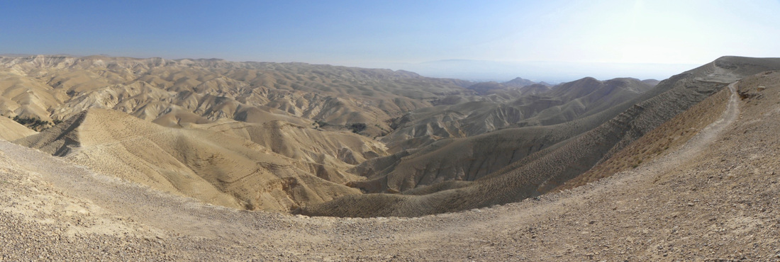
Panorama of the Judean Wilderness by Ian Scott, 2011 - the location of the Good Samaritan story.
Click here for the discussion plans that relate to the ethics in this story.
Good Samaritan Story of Today (English)

The Good Samaritan by Jacopo Bassano
The story of The Good Samaritan can be easily told using
language and scenarios from today, using a story that students can relate to. After
understanding the lyrics and the story of the song, students are to write their
own story in today’s language using a scenario that they may come across at
school.
For example, perhaps a bully in the yard is picking on a student, and many students watch but don’t intervene. A ‘Good Samaritan’ would be the student that stands up to the bully and sticks up for the student getting bullied. Students can think of different scenarios.
Once they have decided on a scenario, they write a script and then create a play. Students can either perform to the class or have it recorded to make a film.
ACELT1614: Analyse and evaluate similarities and differences in texts on similar topics, themes or plots
ACELT1618: Create literary texts that adapt or combine aspects of texts students have experienced in innovative ways
ACELY1714: Plan, draft and publish imaginative, informative and persuasive texts, choosing and experimenting with text structures, language features, images and digital resources appropriate to purpose and audience
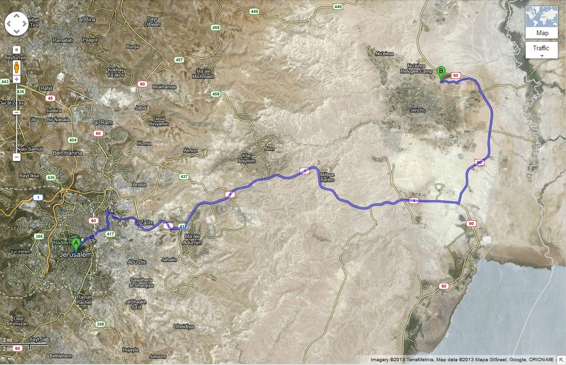
Jerusalem to Jericho
You can find the route from Jerusalem to Jericho by simply asking Google Maps for directions. From here, you can get an idea of the landscape that surrounds this area. You can also encourage students to turn on the 'Photos' filter (you can access this option under a list of options under the 'Traffic' button on the top right, as you can see below).
You can see by these pictures that the trail is far away from civilization and would be a prime location for thieves to wait and then ambush their victims. Below the picture, you can see some questions that your students can answer in this lesson.
You can see by these pictures that the trail is far away from civilization and would be a prime location for thieves to wait and then ambush their victims. Below the picture, you can see some questions that your students can answer in this lesson.
Find the route between Jerusalem and Jericho using Google Maps. Can you find the same area on a paper atlas or a globe?
What is the distance travelled between Jerusalem and Jericho in kilometers? (This answer can be found by using the Google Maps website.)
If you started driving from your school, what could you reach that is approximately the same distance away as the distance between Jerusalem and Jericho?
If you had to convert this into a unit of measurement that was used in Biblical times, what unit would be the most appropriate to use and what would the coversion be from kilometers into this unit? (Check out this Wikipedia article that gives you conversions with the metric system - students will need to give an approximation).
How long would it take driving this route by car? How long would it have taken the man to walk this distance? (These answers can be found by using the Google Maps website.)
What is the current time and temperature in Jerusalem?
By using Streetview, work out which side of the road cars drive on in Israel.
Along the side of the route to Jericho, there are several areas where they have agricultural developments. What do you think they are growing?
If you were to travel this journey by foot and you could take five items with you, what would you take?
Discover what the streets of Jerusalem look like on this great Google Maps page that uses shots taken from Streetview cameras. Some of these pictures are from Jerusalem, some from other parts of Israel. What can you see in these 360 degree panoramics? What can you infer about these places from these photographs?
Side note: if you have a look at this collections page, Google Maps actually provides us with quite a few amazing panoramics from around the world!
